The need to be out and about has become more prevalent with the COVID 19 crisis eating away at the opportunities to leave home. Social distancing rules have made many public venues either inaccessible or limited to the number of visitors allowed at once and the concern of catching the virus and spreading it to a more vulnerable person is enough to keep some from making many trips into public spaces.
Governor Asa Hutchinson has encouraged Arkansans throughout the pandemic to utilize the state’s natural resources for an opportunity to get out of the house while still social distancing.
The Mayo Clinic likewise recommends walking, running and hiking as safe outdoor activities during the pandemic, and the Centers for Disease Control and Prevention (CDC) recommends that those who do want to explore outdoor recreational opportunities go to parks and recreation areas
close to home, since travel, particularly the stops made along the way, can increase one’s risk of contracting the virus since they’re exposed to more people, whether directly or indirectly.
Columbia County offers multiple hiking trails and tracks for residents to utilize should they wish to explore the outdoors.
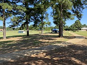
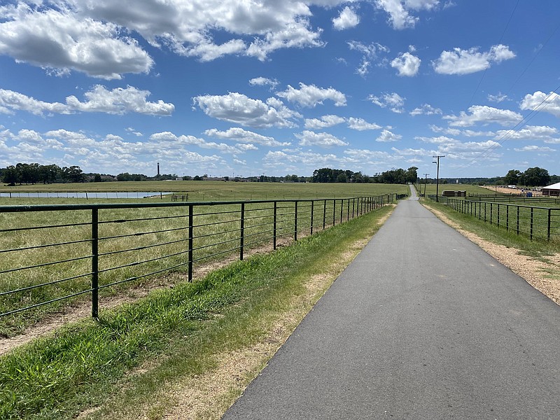
Southern Arkansas University’s Farm Road is a paved path that creates a loop around the farms at SAU. The path is about 2.5 miles long, with benches near the duck pond, beside the barn on the East Farm Road and benches on the sidewalk that runs parallel to East University Street. It is a staple walking location for SAU students, which prompted the University to sell a “Meet me on the Farm Road” T-shirt in their SAU Beyond the Campus shop on Magnolia’s Square.
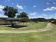
South Side and East Side parks both feature a small track that loops around playground equipment. The CDC recommends careful consideration of playground use, especially if the area is crowded. The CDC also recommends washing hands after using playground equipment.
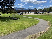
With trees providing shade along portions of the path, the walking track at the Magnolia Regional Medical Center offers more than just an opportunity to walk. Exercise equipment is spaced along the track, with foam grips placed on the handles to keep the metal from getting too hot. The CDC says that it can be difficult to keep surfaces clean and disinfected and
that you should wash your hands when touching surfaces in a public location.
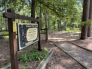
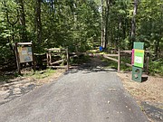
For hiking, Logoly State Park has three trails: the Crane’s Fly Trail, the Spring Branch Trail and the Magnesia Springs Trail. The Crane’s fly Trail is a three-quarter mile round trip that starts at the visitor center and takes hikers across a boardwalk over the park pond, rolling hills and woodland stream habitat. The Spring Branch Trail is a two-mile hike that starts across the pavilion and connects with the Crane’s Fly Trail and Magnesia Springs Trail, before ending at the visitor center. The Magnesia Springs Trail is a half-mile hike that connects the Spring Branch Trail and Crane’s Fly Trail. It also allows hiking access to the Salt Springs area of the State Park.